Former Agricultural Ground
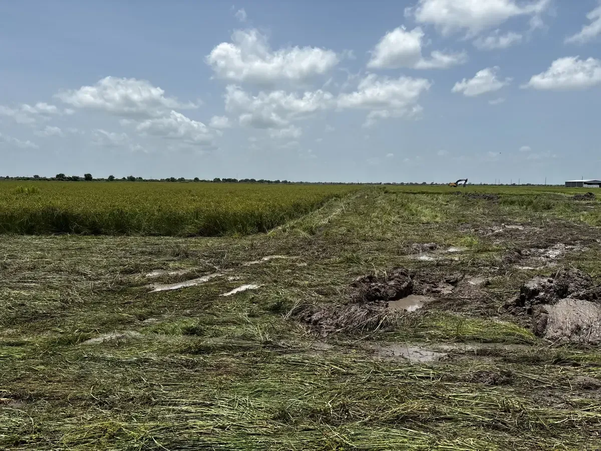
The broad, flat field conditions before the pond and grading work.

Cat Spring, Texas Project
Gulf Coast Conservation built a one-acre pond, reused the excavated native material across approximately eight acres, and cut a rough access path as the first major earthwork phase for a future rural homesite.
The Project
The owner purchased rural acreage in Cat Spring with plans to eventually build a home. The property had previously been used as a rice field and consisted of a broad area of very flat agricultural ground.
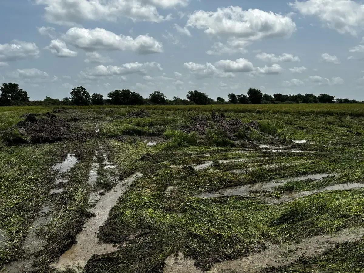
After repeated rainfall before the project began, extensive standing water was visible across the property. Before future home construction could move forward, the land needed an initial earthwork plan that addressed more than one part of the property.
The scope combined two major goals: excavate a roughly one-acre pond and use the resulting native material to establish better grade across approximately eight surrounding acres.
 Before the Work Began
The Starting Condition
The starting condition was easiest to understand from the ground and from the air. The field was largely flat, and recent rainfall had left water sitting across portions of the property.
The broad, flat field conditions before the pond and grading work.
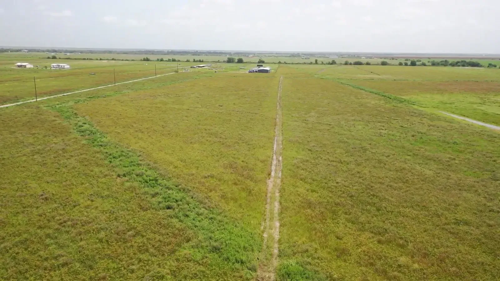
An aerial view of the acreage before excavation and grading began.
Start with the property, the available material, and the grade the land needs.
Building the Pond
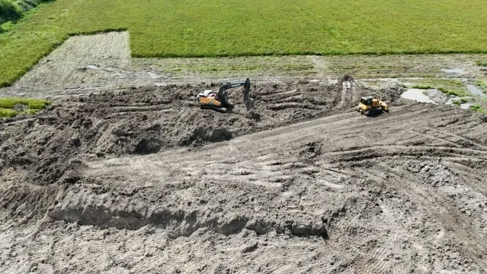
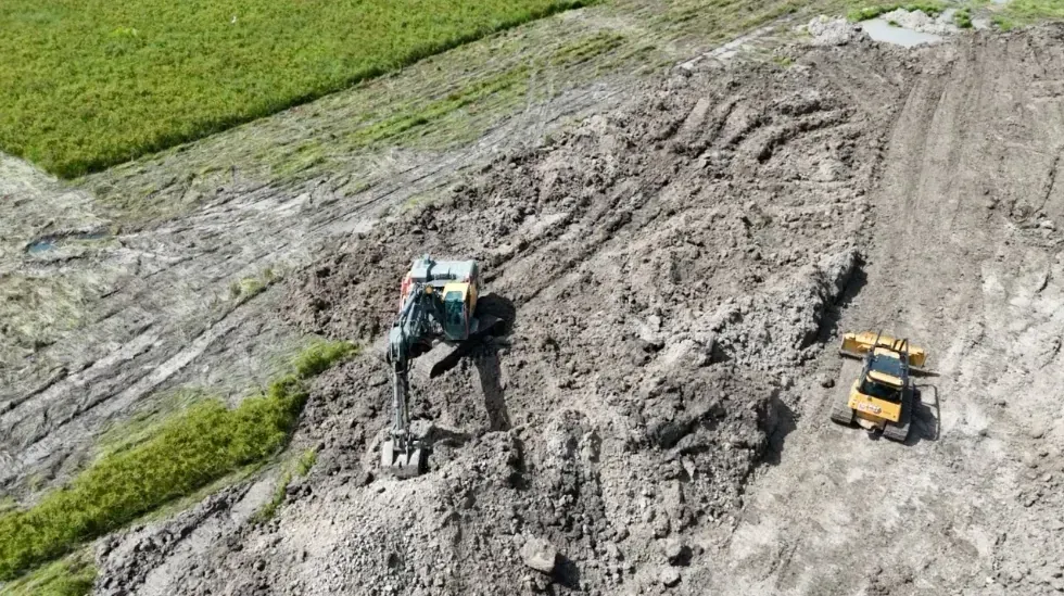
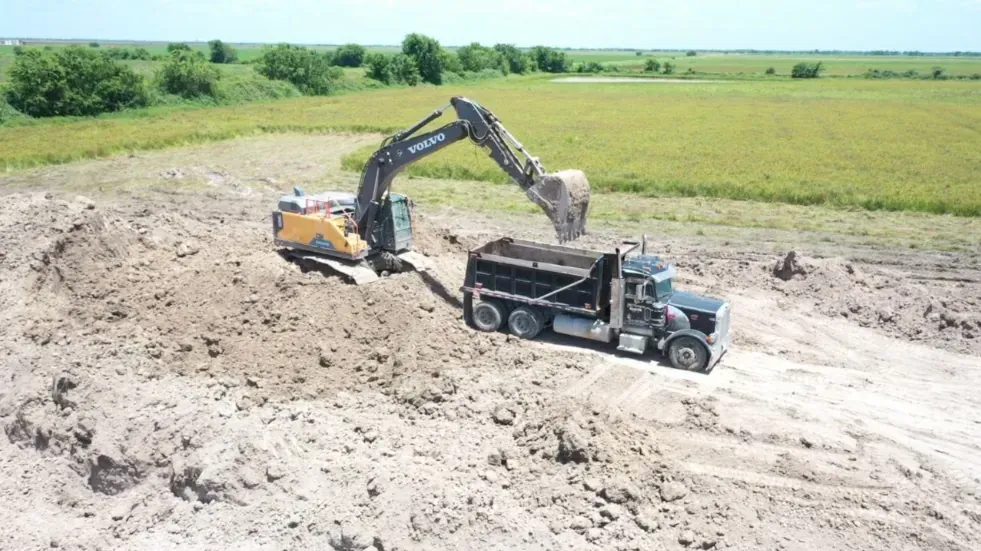
The pond was laid out with an approximately one-acre total excavation footprint. As the excavator opened the pond area, the removed native soil became the material used for the surrounding grading work.
No outside fill was imported, and no excavated soil was hauled away. The material stayed on the property, connecting the pond construction and land grading as one coordinated earthwork plan.
The one-acre figure refers to the total excavation footprint. This page does not claim a measured water-surface area, depth, storage capacity, or engineered pond volume.
Onsite Material Reuse
Excavating the pond was only part of the job. The crew also had to move the native soil efficiently and spread it across the surrounding acreage.
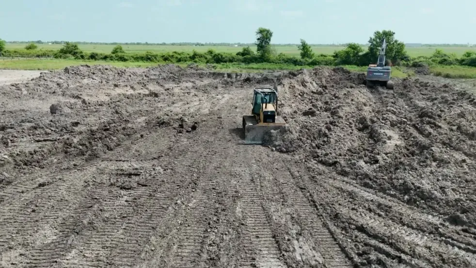
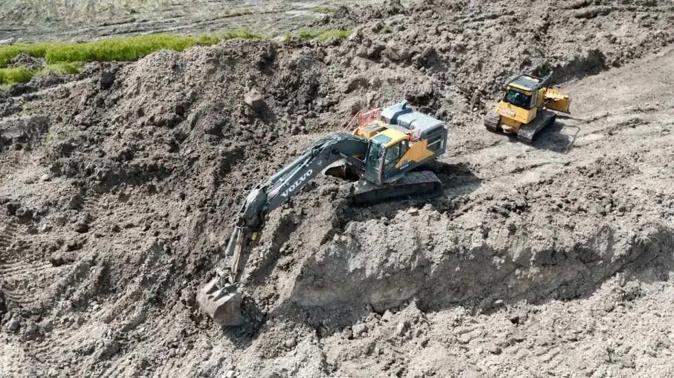
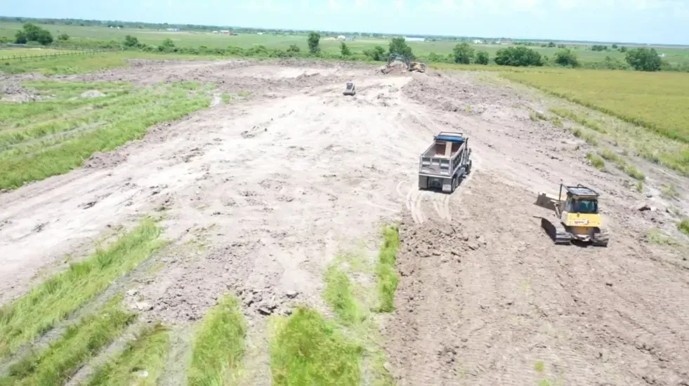
The material was loaded into a tandem-axle dump truck, moved within the property, and spread with a D6-class dozer. A skid steer supported the pond and grading operation.
The final grading established positive slope across the improved area so rainwater could move off the newly shaped surface rather than remain spread across the same flat field condition shown before the project.
How the Project Moved Forward
The work followed a practical sequence that connected the pond excavation, material movement, grading, and access needs.
Start with the flat acreage, standing water, future-home goal, and overall property layout.
Establish the approximately one-acre total excavation footprint.
Open the pond and load native soil for movement within the property.
Spread and shape the material to create positive slope across the improved area.
Create a functional dirt path for entry and exit, without a finished road surface.
About a Week and a Half
The excavator produced and loaded material, the dump truck moved it, and the dozer and skid steer placed and shaped it across the grading area.
Primary pond excavation and material loading.
Bulk spreading, shaping, and grade development.
Support work around the excavation and grading area.
Moving native material within the property.
The Finished First Phase
At the end of the project, the pond held water and approximately eight acres had been reshaped with the excavated native material. The property also had a rough access path for entry and exit.
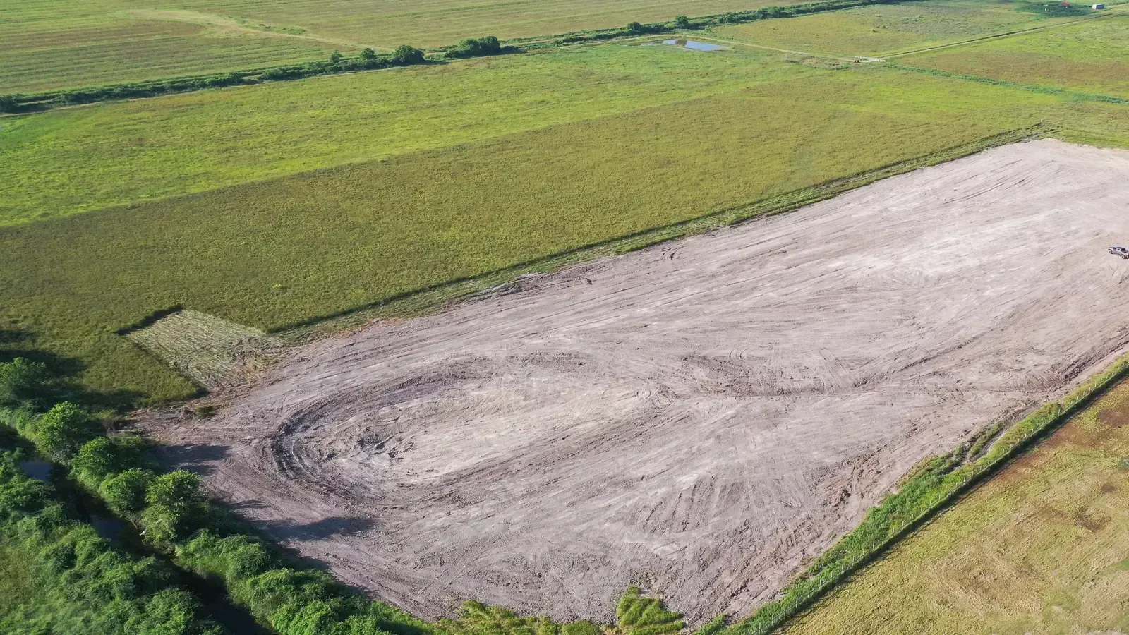
The work did not include a house pad, finished driveway, crushed-concrete road, utility installation, or final home-construction preparation. It completed the first major earthwork phase and gave the owner a more practical starting point for the property's future use.
Project Questions
The pond had an approximately one-acre total excavation footprint. This case study does not state an exact depth or finished water-surface area.
No. The native material excavated from the pond was reused across approximately eight acres. No outside material was imported, and no excavated material was hauled away.
No. The scope included pond excavation, land grading, and a rough dirt access path. It did not include a house pad, finished driveway, crushed-concrete road, or final construction surface.
The pond excavation and primary grading work took about a week and a half.
Yes. The confirmed post-project result is that the pond holds water.
Start With the Property
If your property needs a pond, grading, access, or a coordinated dirt-work plan before the next phase can begin, Gulf Coast Conservation can evaluate the site and help define the work.